Big Hole Road
There is a nuclear war bunker at the end of a road in Pittsboro. Here is what the county's own paperwork says about it.
Chatham County Tax Administration, parcel record 0062817, tax year 2026.
Beneath that field sits roughly 100,000 square feet of hardened concrete.
I drive past Big Hole Road most mornings. For nearly two years, I assumed the name referred to a pond, an old quarry, or some vanished piece of Chatham County farm history. It sounded like one of those rural road names with an explanation both obvious and unavailable, so I never bothered to investigate it.
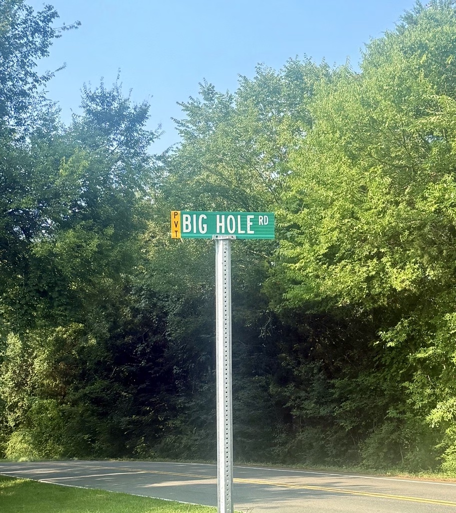
Then, while I was at a customer's house, somebody mentioned that there was a government bunker at the end of the road. They said it casually, in the same tone someone might use to explain where the recycling center is.
So I started looking.
Over the next several weeks, I pulled county tax files, health department permits, site plans, construction records, and nearly seventy years of aerial photography. The documents do not reveal everything about the place. They do answer several questions that have been repeated inaccurately for decades, and they show that the property never became the abandoned ruin it is usually described as.
The short version
In 1962, AT&T acquired 150.38 acres in Chatham County from Mary Elizabeth Hamme McLean and A. F. McLean Jr., then spent four years and roughly seven million dollars building a hardened underground telephone exchange for the U.S. military. It was one of five such sites in the country. The other four are clustered around Washington, D.C.
It went online in 1966, was deactivated in 1996, and was emptied out in 2008.
The original military mission ended. The property did not become an abandoned ruin.
01What you can see from the road
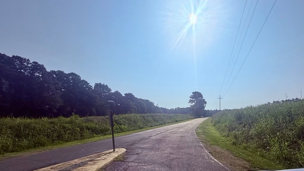
Big Hole Road runs off Mount Gilead Church Road, about a mile south of Fearrington Village. For the first stretch it looks like any other Chatham County dead end. Trees, a few houses set back at odd angles, no traffic.
Then it stops.
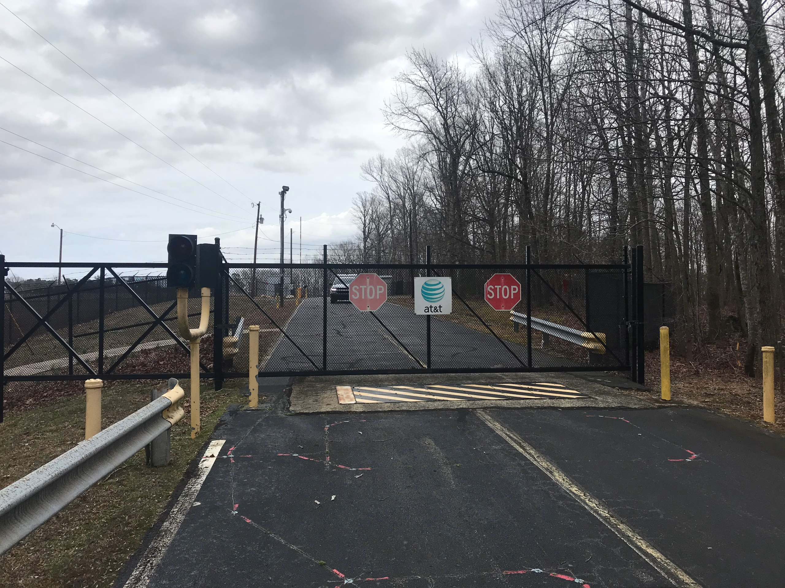
Take a minute with that photo, because it is a county tax assessor's own record of the property.
The first oddity is the traffic signal mounted beside the gate. It controls no intersection. Its apparent purpose is to tell drivers when the yellow and black steel barrier embedded in the pavement is safe to cross.
That barrier is a hinged wedge designed to rise out of the roadway and stop a vehicle. It is not the sort of equipment installed at a forgotten utility yard.
There are two stop signs mounted on the gate itself, flanking the AT&T logo. Guardrail on both sides so you cannot swing around. Yellow bollards. A camera on a pole, and another further in. Barbed wire along the fence, and behind that a berm with a second fence on top of it. There is a guard house inside the perimeter.
The county lists the current permitted use of this property as a telecommunications tower.
02The land AT&T bought from the McLean family
The deed is more specific than the versions of this story that have circulated for years. On October 31, 1962, Mary Elizabeth Hamme McLean and her husband, A. F. McLean Jr., conveyed 150.38 acres in Williams Township to American Telephone and Telegraph Company.
The deed records the consideration as ten dollars and other good and valuable considerations. That is conventional deed language, not proof that AT&T bought the property for ten dollars. I have also seen a $27,000 purchase price and a 191-acre figure repeated in earlier accounts, but this particular deed does not establish either one. Unless another transaction turns up, the cleanest number supported by the land record is 150.38 acres.
The legal description is useful for another reason. It places the new AT&T tract beside lands owned by the Moore Brothers, the Hamme family, and other property owned by or formerly belonging to Mary Elizabeth Hamme McLean. AT&T was not buying an isolated patch from a distant corporate owner. It was cutting a rectangular facility site out of a much larger family landscape.
That larger pattern is still visible in the county map. Chatham County GIS currently shows an adjoining 531.62-acre tract owned by the McLean Family Limited Partnership. The records I have do not prove every step of the family relationship or deed chain, so I am not going to manufacture a genealogy from matching surnames. They do show that a very large block of neighboring land remained associated with the McLean name long after the 1962 sale.
That may help explain why the facility still sits beside such a large expanse of undeveloped land despite decades of growth around Fearrington Village and Jordan Lake. It does not prove that seclusion was part of the sale agreement, or that the family had any role in the site's military purpose. It simply gives the bunker a more accurate setting: an industrial parcel carved from an older rural holding, with hundreds of neighboring acres staying largely intact.
The timing is not subtle. 1962 was the year of the Cuban Missile Crisis. While families were pouring concrete for fallout shelters in their backyards, the federal government was quietly building a national network of hardened sites so the machinery of the United States could keep running after Washington was gone. The planners had a phrase for it: continuity of government.
Excavation and construction took four years. The contractor was Muirhead Construction Company out of Durham. AT&T spent roughly $7 million digging out enough Chatham County clay to drop in a multi-floor structure of about 100,000 square feet, a little larger than a big-box store, except stacked and buried. It came online in 1966.
The hole is where the name comes from. There was no clever code name anybody around here used. There was an enormous pit in the woods that people drove past and talked about, and the road that led to it became Big Hole Road, and it stayed that way.
03What four years of digging looks like from 25,000 feet
Every account of this place, including all the good ones, begins in 1966 or later. The construction itself exists only as numbers: four years, seven million dollars, a Durham contractor. Nobody has a picture of it.
So I went looking in the U.S. Geological Survey's aerial film archive, which holds survey flights going back to the 1930s. Chatham County happened to be photographed twice in 1964, six months apart, while the hole was open and the work was going on.
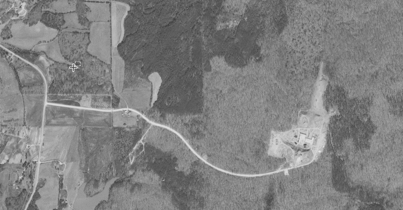
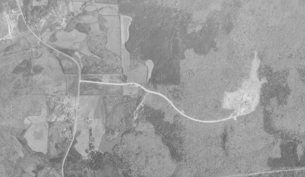
In both frames, a wide, bright track runs east through the trees, conspicuously better built than the farm lanes around it. Four years of heavy construction traffic had to reach the excavation somehow. These photographs appear to show the access route being cut and improved while the bunker was under construction.
That road is the likely origin of the name, although an older farm track may have followed part of the same alignment before AT&T arrived. The aerial record is clearer about the construction work than it is about who first made the path.
04Sixty-eight years from above
Chatham County GIS historical orthoimagery · scroll sideways · click any frame to zoom →
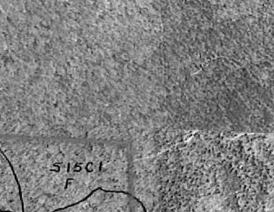
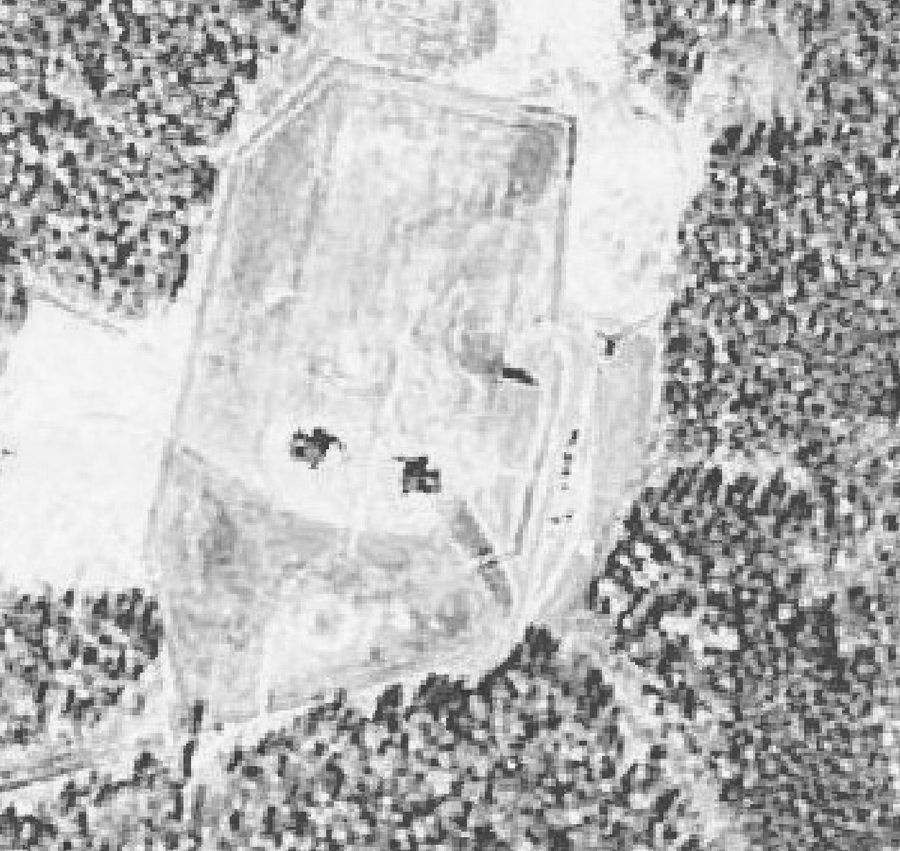
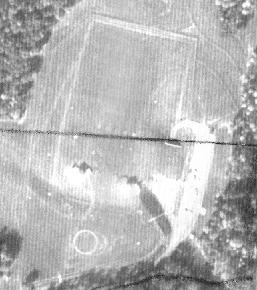
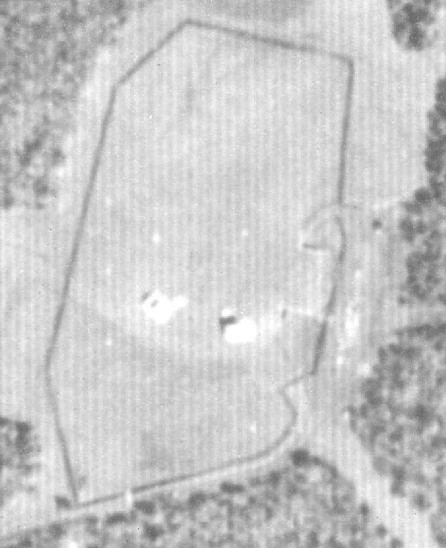
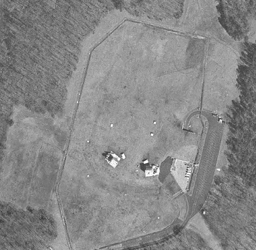
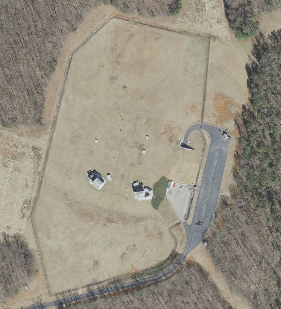
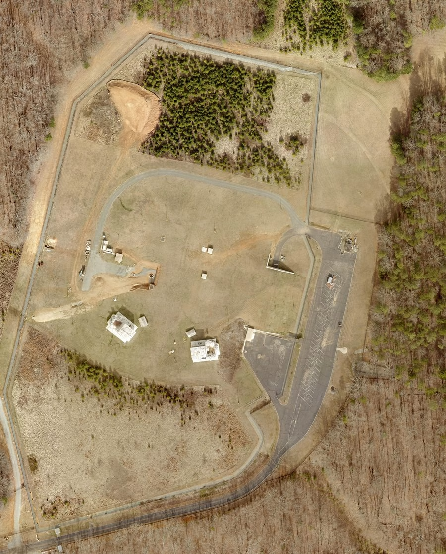
Imagery: Chatham County GIS, exported at 300 DPI. 1964 construction frames: U.S. Geological Survey, EROS archive.
Two things fall out of that sequence.
The antennas came down sometime between 1983 and 1997. That fits the industry's shift from tropospheric scatter to buried fiber, and as far as I can tell nobody has ever pinned the date.
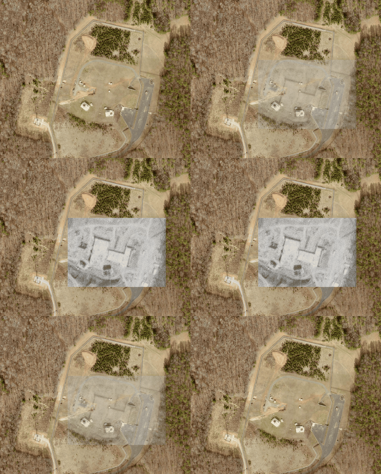
The small white squares do not move. They appear in the same positions in 1997, 2002, 2007, 2013, 2017, 2019 and 2023. The tax record lists four small surface structures, and the aerials appear to show them. They may be vents, access points, utility housings, or some combination of the three.
Whatever their exact purpose, they reinforce the basic geography of the site: the field is not beside the bunker. The field is over it.
I was able to mush together the photos from construction in the 1960's to our HD-resolution 2023 photo and for the first time online (I believe) you can see what the buildings undground may look like.
05Copper walls, rubber pipes, and a building on springs
The engineering is less mysterious than the rumors. It is also more revealing.
The walls are roughly a foot and a half thick and sheathed in copper. That is not for strength. Copper shielding stops electromagnetic pulse, the surge a nuclear detonation throws off that will kill unshielded electronics from a long way away. Somebody calculated that this building needed to keep its telephone switching gear alive through an EMP event.
The lower floors do not rest on the ground. They are suspended on a cradle of springs and gravel so a near miss shoves the earth around without shattering what is inside. The structure sits about thirty feet down.
And then my favorite detail. The plumbing has rubber links in it, so the pipes and toilets can flex when the building rides out a shock instead of snapping.
Which brings me to a document I did not expect to find.
06What the septic file knows
Chatham County's Environmental Health division keeps a file on this property, because the facility runs on a septic system and septic systems are regulated. In that file is the original design basis, hand-lettered, from the construction era.
It records the soil absorption pit tests, northeast and southwest. It specifies a 2,700 gallon septic tank, two alternating dosing siphons, a distribution box, and 1,440 feet of tile field laid in two beds of eight laterals at ninety feet each.
And under POPULATION, it says this:
Seventy people. Around the clock. That is what the place was built to hold, and it is the closest thing to a staffing number that exists in any public document.
What the permits do tell you is that the system is live. It is inspected twelve times a year. It requires an active contract with a certified subsurface operator. There is an annual monitoring fee. It was renewed in 2004, again in 2011, and again in October 2020.
Whatever the site's current purpose, AT&T was still maintaining an operating permit that required twelve inspections a year. That is difficult to reconcile with the usual description of the property as abandoned.
07Why Chatham County?
This is the question that makes Big Hole genuinely odd, and most accounts skip it.
Big Hole is one of five facilities AT&T built under a program it called Project Offices. The other four are Hagerstown in Maryland and Leesburg, Peters Mountain and Short Hill Mountain in Virginia. All four sit within easy reach of Washington, D.C., which makes obvious sense if the point is to evacuate federal leadership.
And then there is Chatham County, North Carolina, two hundred and fifty miles south, alone.
There is a declassified partial answer. A 1983 Army Signal Corps manual lists the siting criteria for facilities like this: good access roads, room for independent power and reliable air conditioning, and a location outside dense population but near military installations.
Chatham County in 1962 was quiet, rural, cheap, and about eighty miles from Fort Bragg and Pope Air Force Base.
That is the working theory and it is a good one. This was not built for Washington. It was built for Fort Bragg. Far enough to survive a strike on the largest Army base in the country, close enough to still command what was left of it.
But there is one thread nobody has pulled all the way.
The Greenbrier switchboard
The Greenbrier Resort in West Virginia is famous now. Under a luxury hotel, the government built a relocation facility for the United States Congress. It stayed secret for thirty years until a Washington Post investigation blew it in 1992. You can tour it today.
Inside was a telephone switchboard. According to reporting by INDY Week, two of the labels on it read CHATAM and HGRSTOWN.
I have not seen that switchboard myself. Photography inside the bunker is restricted and the images that exist are controlled by the resort or by wire services, so I am taking it on the reporting rather than on my own eyes. But if it is right, and I have no reason to think it is not, then Congress's doomsday bunker had a labeled line to a hole in the ground in Chatham County.
Rebecca Kastleman, who grew up in Chatham County and now teaches at Columbia, published a peer-reviewed article on this site in 2020. She has argued that the remoteness may have been the point, and that the better question is not why they built it here, but who exactly the President was expected to reach at this specific spot.
I do not have an answer. Neither does anyone else who has written about it.
08What it was actually for
Worth deflating this, because the mundane version is more interesting than people expect.
Big Hole was a telephone exchange. Specifically, a switching center on AUTOVON, the Automatic Voice Network, the military's own private telephone system. The Defense Communications Agency put AUTOVON in service in 1964. Chatham came online two years later.
Around sixty AUTOVON centers were built nationwide. Twenty of them, including this one, were hardened and underground.
And AUTOVON was not idling while it waited for the end of the world. A 1987 directory reported roughly 180,000 access phones handling about 1.1 million calls a day. It carried orders and it carried completely routine traffic, and at some point it effectively became free long distance for service members who knew the access codes.
So the picture is not a secret laboratory. It is a shift of technicians in a very expensive basement routing phone calls for Fort Bragg, with three weeks of canned food and a decontamination chamber down the hall in case today turned out to be the day.
I find that more unsettling than aliens.
09Is it really thirteen stories deep?
You will see thirteen everywhere. Thirteen stories, thirteen floors, an underground skyscraper.
I traced it. In 1997, in the first weeks of a Chatham County online mailing list, somebody posted that the facility was thirteen stories deep. That is the source. One person, on a listserv, in 1997.
Twenty-nine years later that number is in national magazine articles, and as far as I can tell it has never been attached to anybody who actually went down there.
Somebody who did is Bobby White. He worked at Big Hole for thirty-one years as a technician, retired in 1999, and now raises cattle in Chatham County. He told WUNC's podcast The Broadside in 2025 that it was three stories deep, and described it as basically a regular telephone office that happened to be hardened.
He needed a top secret clearance. He saw generators and switching equipment. No labs. He has heard the rumor that it was an underground refueling station for submarines, which is a good one, because Chatham County is a hundred and twenty miles from the ocean.
The other account worth knowing comes from Drew Lasater, who visited her father at work there in the 1970s. She remembers going down and down through tunnels as a small kid. She also remembers exactly when the visits stopped. Once she started first grade, she was not allowed inside any more.
That detail has nothing to do with UFOs or secret experiments. It is useful because it is ordinary and specific. There was enough visible information inside the facility that a child who could read was considered a security risk.
While we are correcting things
A few claims travel with this story and belong to other sites entirely.
| You will read that | What is actually true |
|---|---|
| $61 million in upgrades in 2007 | That was Peters Mountain, Virginia, per Albemarle County permits. |
| "Project Aurelia," a Costco-sized expansion | Short Hill Mountain, Virginia, 2016. AT&T dropped it after Loudoun County proposed a public hearing. |
| A moat was dug around it | No source I can find. Probably a stormwater or security berm. |
| The site is officially called "NC-1" | A placeholder a researcher invented in 2004. More on that below. |
10What the tax office knows
The county tax file creates a different kind of mystery, one produced by ordinary accounting rather than classified history.
Parcel 0062817. Owner: American Telephone & Telegraph. 150.38 acres, down from the original 191 after a parcel split recorded on the last day of 2000. Zoning: IND-H, Heavy Industrial District. In rural Chatham County.
Total market value: $2,384,430. Of that, $2,256,397 is land. Which leaves $128,033 for everything built on it.
The county's improvement record for this parcel lists asphalt paving, fencing, one yard light, and four small shops of 96, 80, 80 and 100 square feet. Those four shops are almost certainly the little white squares you can see in every aerial since 1997.
Under total finished area, the county records zero.
The county classifies the parcel as fully exempt. Assessed value: $0. Tax rate: 0.0000. Total tax billed: $0.00. The payment history shows $0.00 due and $0.00 paid for every year listed.
I want to be careful with that, because "AT&T pays no taxes on a nuclear bunker" is the kind of sentence that travels fast and is probably wrong.
North Carolina law treats telephone companies as public service companies, and the property they use in providing service is appraised by the state Department of Revenue rather than by the county. The state then certifies those values back to the local taxing units, which apply their own rates. If that is what is happening here, and it is the likeliest explanation by a distance, then AT&T is paying. The number simply is not generated in Pittsboro, so it never appears in Pittsboro's records.
I tried to confirm the specifics and could not get further than the statute. So what I can tell you is exactly this much: the county's own file shows no assessed value, no tax rate and no payments, and the county does not appear to have appraised the structure at all.
Which makes the last line in the file read a little differently. On March 4, 2020, during a revaluation, a county employee noted:
They were turned away at the gate. And in a sense it did not matter, because the building was never on their books to begin with.
11Is it still being used?
Officially, no.
The Defense Information Systems Agency says AT&T deactivated the Chatham site in 1996 during the transition to a newer digital network. Bobby White retired in 1999 and says they closed it shortly after. In the summer of 2008, neighbors watched convoys haul equipment out over several weeks and the guard force went away.
That should be the end of it. Here is what the record actually shows.
More than twenty-five vehicles in the parking lot. Five years after the reported shutdown, and substantially more than in 2007, the last year anyone agrees it was operating.
A loop road appears that was not there in 2017. New pavement, new western apron.
The septic operating permit is renewed for another sixty months. Twelve inspections a year.
A county assessor is turned away at the gate.
Chatham County Environmental Health approves a setback compliance application. Stated purpose: telecommunication tower, 217 feet.
Permit 23-3280 issued. Fresh excavation appears on the west side of the property.
The tax office adds a line item to the parcel: one acre, classified as cell tower site, valued at $37,500.
So the 2023 digging has a boring answer, and I want to give it plainly, because a lot of people online have decided it means something else. They built a cell tower. It is permitted, it is on the tax roll, and the paperwork is public.
The tower explains the 2023 excavation. It does not account for the vehicles visible in 2013, the pavement added by 2019, or the continued septic permitting. The clearest acknowledgment of the underground structure appears in a routine county site plan from 2022.
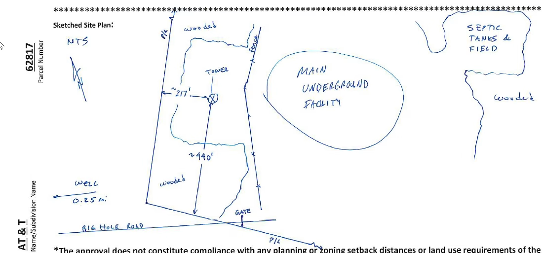
This is not a rumor or a recycled listserv post. It is a Chatham County government document, dated 2022 and drawn by a county employee, labeling the structure beneath the field.
And one more thing
There is a website called coldwar-c4i.net, run by a researcher named Albert LaFrance. It is one of the most careful public archives of American Cold War communications infrastructure that exists. Not a conspiracy site. It publishes scanned Signal Corps documents and network diagrams.
LaFrance keeps a public changelog of every edit he has made since 1999, with timestamps. Read it in order.
He creates a page for the AT&T Project Offices, with a map of the troposcatter paths and a link to a magazine article about the Chatham station.
He deletes all information for Charlottesville, Leesburg and Chatham, North Carolina. The changelog gives the reason: at the request of AT&T Corporate Security.
Seventy minutes later, he pulls external links for six more AT&T sites for the same reason.
The pages come back, but the active facilities are now listed under invented names. Chatham returns as NC-1.
Two more rounds. Real names replaced with internal AT&T location codes, each noted as complying with a request from AT&T Corporate Security.
I want to be careful, because this is where these articles usually go off a cliff.
None of this is evidence of anything supernatural. Large companies routinely ask people to take infrastructure details offline, and there are ordinary security reasons to do it.
But it is a documented, timestamped fact that in 2004, eight years after this facility was publicly described as deactivated, AT&T's corporate security operation contacted a private hobbyist historian in Virginia and asked him to scrub Chatham County off his personal website. Then did it again. And again.
Put the whole record together and the picture is consistent. Deactivated in 1996. Emptied in 2008. And since then: a full parking lot in 2013, a new road in 2019, a septic permit renewed and inspected monthly, an assessor turned away at the gate, a 217 foot tower approved in 2022, and fresh construction in 2023.
"Abandoned bunker" is simply the wrong description, and it is the one nearly every article uses.
12Is Big Hole the real Hawkins Lab?
I have to address this, because it is why a lot of people end up searching for this road.
There is no evidence that Big Hole directly inspired Hawkins Lab. The real connection is looser, and more believable.
Matt and Ross Duffer were born in Durham on February 15, 1984. Duke School, then Jordan High School. Durham is about forty minutes from Big Hole Road.
But the documented origin of Hawkins Lab is not Chatham County. The show was written and pitched as Montauk, set in Montauk, Long Island, because the brothers became fascinated with the Montauk Project conspiracy theory while making a school documentary. The lab's human experimentation storyline draws on MKUltra, the real CIA program from the 1950s. The setting moved to fictional Hawkins, Indiana for production reasons, since they were shooting in Atlanta.
Nobody has to invent a connection. There is a paper trail and it points to Long Island.
What is true is that two kids grew up in Durham in the 1990s, about forty minutes from a real, guarded underground military communications facility that local adults rarely discussed. Matt Duffer has called the show a love letter to their North Carolina childhood, and the series uses North Carolina names including Kerley Street, Cornwallis Road and the Eno River.
And Jordan Lake, which in the show sits near the lab, and which in the real world is in Big Hole's backyard.
That proves nothing. But if you had never heard of Montauk, and somebody drove you down Big Hole Road on a gray February afternoon and stopped at that gate, you would not need to change much.
13Can you visit?
No. Please do not try.
Private property, posted, monitored, and that crash barrier in the driveway is not decorative. In 2025 a WUNC producer drove out, pushed the intercom, got no answer, thought about the fence and decided against it. That is the right call and it is the standard I used. Every photograph I took is from the public road.
The neighbors on that road have been fielding curious strangers for sixty years. Be the person who photographs the sign and leaves.
14Questions people ask
What is Big Hole Road in Pittsboro, NC?
A dead end road off Mount Gilead Church Road, about a mile south of Fearrington Village. It leads to a hardened underground communications facility AT&T built for the U.S. military between 1962 and 1966. The road is named for the excavation dug during construction.
How deep is the Big Hole bunker?
Commonly reported as thirteen stories, but that traces to a single 1997 post on a local mailing list. Bobby White, who worked there thirty-one years, has said publicly it is three stories. The structure sits roughly thirty feet down and covers about 100,000 square feet.
Is the Big Hole still active?
The military mission was deactivated in 1996 and equipment was removed in 2008. But AT&T still owns the property, county records show a septic permit renewed in 2020 with monthly inspections, a 217 foot telecommunications tower was approved in 2022 and added to the tax roll in 2023, and aerial photography shows continued construction. The site is not abandoned.
Who owns Big Hole?
American Telephone & Telegraph. Chatham County parcel 0062817, 150.38 acres, zoned Heavy Industrial.
Can you visit Big Hole in Chatham County?
No. It is private property, posted against trespassing, monitored by camera, with a vehicle crash barrier at the gate. Everything worth seeing is visible from the public road.
Did Big Hole inspire Stranger Things?
There is no evidence it did. The Duffer brothers, who grew up in Durham, originally set the show in Montauk, Long Island, drawing on the Montauk Project and MKUltra. Big Hole is, however, the closest real world equivalent to Hawkins Lab in North Carolina.
Where is Big Hole Road located?
Off Mount Gilead Church Road in Pittsboro, Chatham County, North Carolina, about a mile south of Fearrington Village and a few miles from Jordan Lake.
Sources and further reading
- Jon Elliston, "Big Hole, Deep Secret," INDY Week, December 13, 2000
- Hannah Kaufman, INDY Week, July 13, 2022
- "The mystery of the Big Hole," The Broadside, WUNC, May 8, 2025
- Jay Price, "Mysterious Cold War bunker closes," Charlotte Observer, August 10, 2008
- Albert LaFrance, A Secret Landscape
- The Center for Land Use Interpretation, AT&T Chatham Big Hole Site
- Rebecca Kastleman, "Big Hole: Excavating Intimate Histories of a Nuclear Homefront," 2020
- Wikipedia, AT&T Project Offices
- N.C. Gen. Stat. § 105-333 and § 105-335, public service company property
- Chatham County Register of Deeds, deed book 284, page 199, Mary Elizabeth Hamme McLean and A. F. McLean Jr. to American Telephone and Telegraph Company, October 31, 1962
- Chatham County Public Health Department, Division of Environmental Health, operation permits and site plans, parcel 62817
- Chatham County Tax Administration, parcel record 0062817
- Chatham County GIS, historical aerial photography, 1955 to 2023
- U.S. Geological Survey, EarthExplorer, Aerial Photo Single Frames